Wel Come To Finfine Branch
Overview
Finfine branch is one of the nine branches of Oromia Forest and Wildlife Enterprise which is established by regulation number 122/2001 in June 2009 to develop, manage, protect and sustainably utilize forest and other forest related resources in central part of Oromia by involving the people and implementing multiple use forestry to effectively contribute to economic development and improvement of the wellbeing of the people.
It is also mandated to expand the forest and wildlife areas outside its concession through the active participation and involvement of different stakeholders particularly the local residents living in and around the forest and wildlife areas. The branch plays also a very great role in livelihood improvement by providing employment opportunity and creating alternative means of earning to the local community.
ABOUT US
The forest concession of the branch is located in five zones, 25 Woredas and 137 Kebeles in the central part of Oromia extending from the surrounding environments of Finfine 160 kilometer in the Jibat forest in the West, 150 kilometer in the South east at Adami tulu and 189 kilometer in the North at Dara and some 190 kilometers to the East in Fentale and Bosete Woreda.
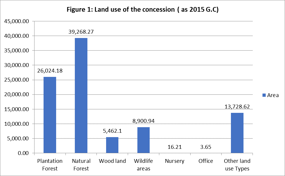
The branch has a total concession area of 93,403.97 hectares out of which 23,782.86 hectares of self-managed plantation forest and also 2,241.32 ha PFM plantation forest. The natural forest has a total area of 35,448.60 hectares. The wood lands have also a total area of 9,281.77 ha. Wildlife area with legally authorized boundary has an area of 8903ha. Other land use types of the concession constitute 13,728.62 hectares.
The topography of the area is mainly dominated by volcanic undulating landscapes. Mountains and hills are separated by broad river valleys. Most of the landscape has a slope of more than 40%. This is exposed to soil erosion as soon as the vegetation is removed. Most of the areas are located on high altitudes above 2000m.a.s.l. The altitude ranges from about 1600 meter at Selk amba in the South of the Jibat forest to about 3,385 meters above sea level at Damocha the crystalline rock at the peak of mount Wechecha.
The concession area is found almost in all types of agro ecological zones from kola at the low lands of Matahara and Gara aluto at Adami Tulu to weyina dega and Dega on the mountain ranges at the vicinity of Finfine to Jibat, Chilmo, and Gedo forests. The high-altitude experiences moderate tantalizing climate modified by altitude and the influence of the forest.
Most of the highlands experiences bimodal rainfall with short usually unreliable rainfall from March to May. The long rainy season is more important for plant growth extends mainly from June to September with little local variation. The respective values range of rainfall and evaporation (P, PET) during long rainy seasons for the high lands is (736,337).
The maximum and minimum mean monthly temperature value is 11- 260c reflects that the area experiences cool climatic condition which is vital for survival and growth of plantation forest. Small areas of the forest is exposed to frost on high altitude at Ankorcha during extreme monthly minimum temperature which is (6oC), the temperature record reveals that most of the area are cool sub-humid. The lowlands on the other hand at Matahara, Adami tulu and Selk amba areas experiences hot climatic condition.The respective values range of rainfall and evaporation (P, PET) is high in these areas which is harsh for survival and growth of commercial forests.
The forest areas are the source of many permanent and temporary rivers that gestures to large river basins of Awash, Gibe and Abay. Large volumes of water from these rivers are very important for household and industrial uses. Almost all the dams for power generation and water for various uses without exceptions including the Great Renaissance Dam in the country are dependent on the water resources of thesewater shades. Small and large scale irrigationsthat play a very great role in poverty reductionare dependent on water from these water shades.
Soil is mainly volcanic origin. There is a great variation in depth and type of soil from place to place. Soil depth is shallow on the escarpments of mountainous areas at Barak, Yerer, Boreta, Debregelan, some areas of Chancho, Kerabu, Intoteleshe and Furi mountains. Other areas of the forest concession including Suba, Jibat forest in general have relatively deep soils good for forest growth. Sandy clay and loam soils are the dominant soil types in the natural forest. The mountain slopes features silt and clay soils whereas the valley bottoms are dominated by clay loam soils deposited by the action of erosion.
Even though greater variability in Soil type, fertility and depth exists in the areas of our forests most of the areas could support plantation development through the application of scientific and technical details of forest management in species selection, spacing and appropriate tending operations that corresponds to the ecological requirement of the selected species.
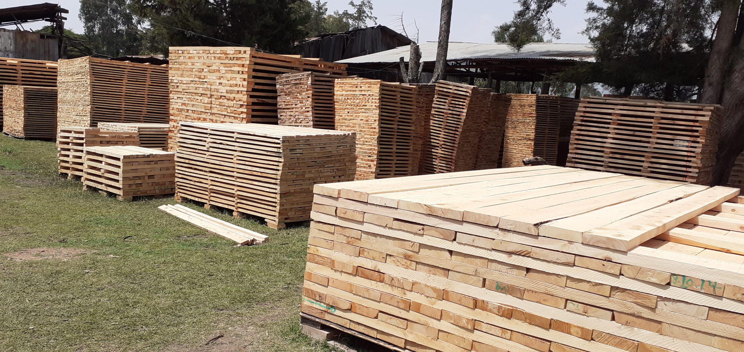
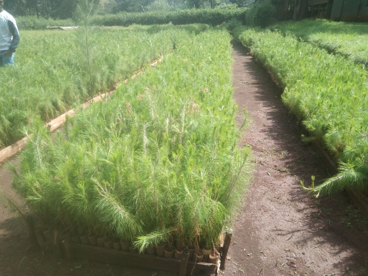
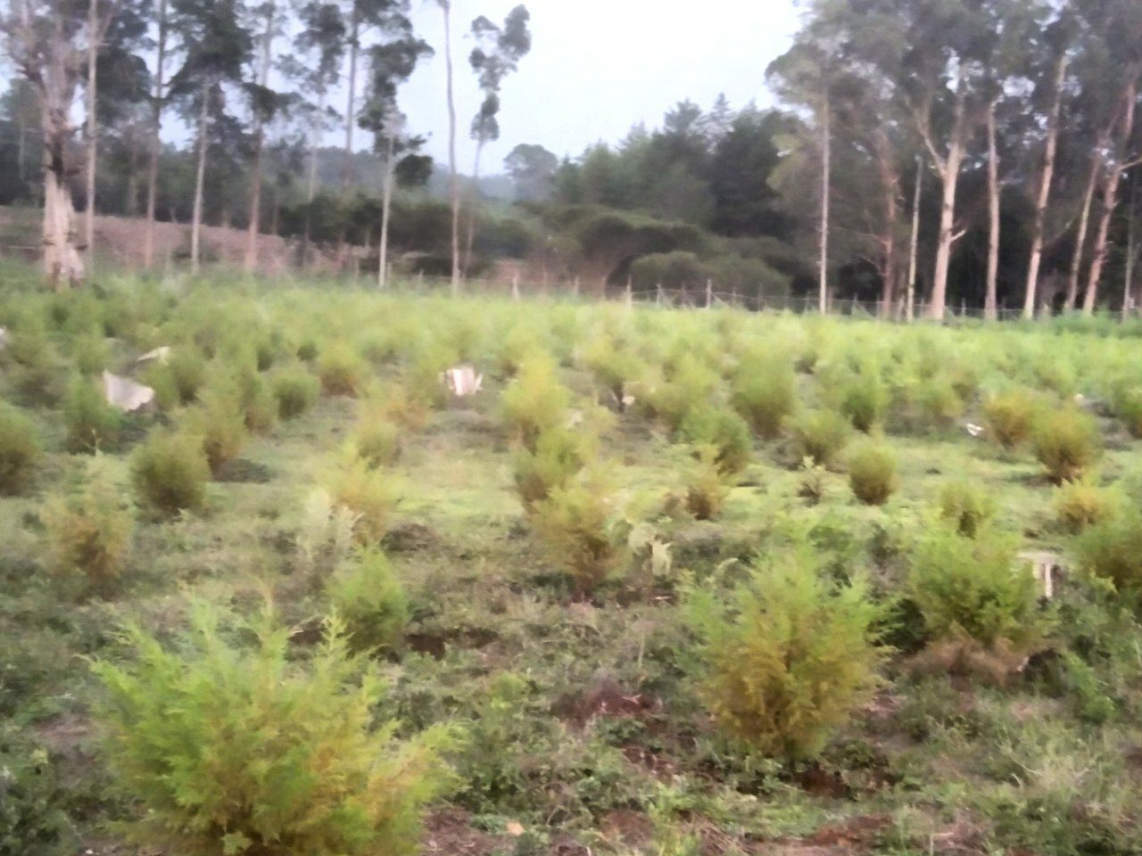
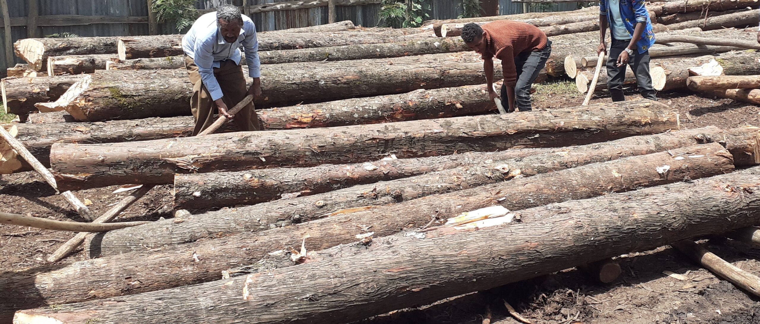
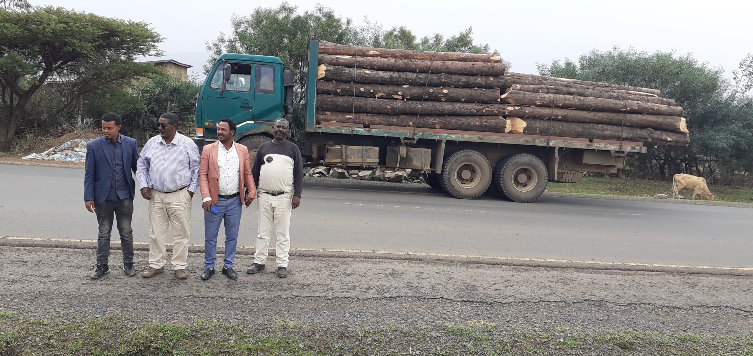
In terms of land use the greater part of the concession is used for plantation forestry and conservation of natural forests and woodlands. A number of small properties are used as nursery, office and residential quarter. The branch operates in eight tree seedling nurseries in which all are legally owned by the branch. Considerable areas with in the forest concession accounting more than 13,728.62 ha of land and the adjoining land are dominated by mixed farming mainly crop production and livestock rearing. Plantation forests, in separate ownership private lots and community forests are also common neighbors to our forests. Settlement and other investment forms resulted from an increased human population and growth and industrial development of the nation are the other features of the land use that are computing and threatening the forest concession.
The forest vegetation displays greater variability in species composition resulted from variation in topography, altitude, climate and soil and other human induced factors.
The commercial forest plantation is dominated primarily by Eucalyptus Species constituting more than 92.66% of the plantation forest. Cupressus lustanica and pinus species other exotic species constitute 5.9 %. The other exotics including Gravielia and Acacia deccurence covers 0.32 % of the plantation forest. The indigenous plantation forest which is composed of few indigenous species including Juniperus procera, Podocarpus falcatus, Hagenia abyssinica, Cordia africana and Olea europea constitutes 1.11% of the plantation forest.
No | Species | Area | Area Proportion (%) |
1 | Eucalyptus globules | 20,633.43 | 86.75 |
2 | Eucalyptus camaldulensis | 1,104.75 | 4.64 |
3 | Eucalyptus saligna | 262.57 | 1.1 |
4 | Eucalyptus grandis | 37.35 | 0.16 |
5 | Eucalyptus viminalis | 0.23 | 0 |
6 | Cupressus lusitanica | 1,293.69 | 5.44 |
7 | Pinus patula | 44.71 | 0.19 |
8 | Pinus radiate | 65.27 | 0.27 |
9 | Juniperus procera | 191.77 | 0.81 |
10 | Podocarpus falcatus | 16.76 | 0.07 |
11 | Hagenia abyssinica | 42.9 | 0.18 |
12 | Gravielia robusta | 36.65 | 0.15 |
13 | Acacia decurrence | 40.1 | 0.17 |
14 | Cordia Africana | 7.96 | 0.03 |
15 | Olea Europea | 5.49 | 0.02 |
Sum | 23,783.62 | 100 |
Since most of the plantation forest is bordering with the city of Addis Ababa and other emerging towns anthropogenic and natural factors such as human encroachment and Intrusion of domestic animals threatens the continued existence of the forest. Uncoordinated activities between the sectors of government associated with lack of accountability have exposed the forest resource for un lawful usage that highly threatens its sustainability.
The natural vegetation is composed of semi humid land vegetation type modified by the unique local environment. The valley bottoms, riverine areas and upper slopes within the forest are covered with remnant native tree and shrubs of high diversity indicating the pristine vegetation types of the area.
The natural forest is affected by various activities of human beings mainly deforestation for settlement and agricultural practices. Deforestation in the past decades reduced the size of the forest. Forest degradation is another form of forest destruction whereby the most valued species being removed from the forest and reducing the productive potential of the forest for sustainable harvest. Most of the natural forests in our concession have been affected by both deforestation and forest degradation. The only remnant primitive forest growth with relatively better and diversified species composition is found in the central part of the Jibat forest below the mountain summit in the South west direction.
The wood lands in wildlife areas in the rift valley region and Dara incense site are dominated mainly by tree species of Acacia, Boswelia and Commiphora species. Other drought tolerant species of shrubs and ground herbs, an important browse for wild animals are also the characteristics of the wood lands.
All of our forests especially the natural forest has environmental and social value. The values it contains include rare and endemic species, rare habitats and recreational sites or resources used by tourists and local residents. These values have high significant biodiversity values or high conservation values of the forests. During the extensive assessment of the forest wild mammalian species are noted and recorded both in the plantation and natural forests.
The role of the forest in supporting the remnant mammalian and diverse especially high land biome species of birds is an outstanding significance for biodiversity conservation. Areas most important for biodiversity or wildlife value include:
- Jibat forest serves as a refuge for 11 mammalian species and more than 150 species of birds
- Suba forest home for 8 mammalian and 143 bird species that includes rare and endemics
- Yerer forest home for 10 mammalian species and more than 103 species of birds
- Barak and Chancho plantation forests are home for medium sized antelopes
- Remnant native vegetation
The branch will provide high protection emphasis for endemic, rare, endangered and threatened species and threatened ecological communities. These protection measures include:
- Developing and adopting protection prescriptions. These prescriptions will be based on the results of monitoring outcomes.
- Mapping the distribution and location of known threatened species
- Identifying further areas or sites supporting threatened species;
- Identifying, monitoring and controlling threatening processes (including investigating the impact of company management activities and developing practices to mitigate these impacts) that endanger threatened species;
The livelihood of the people is generally based on agriculture mainly consisting of crop production and animal husbandry. The most important crops that were produced in the areas have been teff, wheat and maize.
The population is very dependent on the forest for fuel wood and construction poles. The forest areas are frequently used for grazing and grass collection for animal feed and roofing huts.
Currently considerable number of people participates in the forest protection and development activities of the enterprise and considerable amount of money is directly channeled to the hands of the local people through permanent and temporary employment opportunities. Very few people also generate additional income from sport hunting companies for the service they provide at the hunting campsites.
The total number of households around the forest in the study area is 1729 of which 1257 are male and 472 female. The average land holding of the households is 1.89 ha. The inhabited areas are mainly at the foot of the mountain outside the forest concession. The livelihood of the people is generally based on agriculture mainly consisting of crop production and livestock rearing. The people grow mainly teff and wheat and there are no cash crops grown in the area. Animal husbandry is restricted to poultry, sheep and cow. Beef cattle are reared in very limited households.
The population is very dependent on the forest for fuel wood and construction poles. The fuel wood collected from the forest is used for cooking and sometimes for sale in the surrounding towns such as Dukem and Debrezite. Some medicinal plants grow in the forest and are used on regular bases as traditional medicine. The forest area is also frequently used for grass collection on the cut and carry practice for livestock feed and for roofing huts.
Considerable number of people participates in the forest development activities and generate considerable amount of additional income through permanent and temporary employment opportunities by the branch.
The Branch office is located in the Capital City of the country, Addis Ababa. This Branch is further structured into six Districts offices, namely: Barak, Chancho, Intoto Eka, Jibat Gedo, East Shoa and Suba Sebeta.
SUBA FOREST PARK, Since 15TH Century

Visitor’s Information Guide
Oromia Forest and Wildlife Enterprise (OFWE) is a public development enterprises, established with Regulation No.122/2009 in accordance with Article 49 (1) of Proclamation No. 87/2005, with the mission to undertake sustainable protection, development and utilization of forest and wildlife resources in Orormia region through community participation, enhancing business investment, and subsequently contribute to national economic development. OFWE administering nearly 4million hectar of Widlife and Forest protected areas. This guide provides you with information on 6 of the best places to visit in Oromia.
Discover ‘AFRICA’S OLDEST PARK’
Location & History
Suba Forest is Africa’s oldest treasure hidden at about 55km southwest of capital Addis Ababa, location 9089’ to 9000’ North Latitude and 38031’ to 38035’ East Longitude. The history of protection of the forest goes back as early as 15th century. The forest was designated as National Forest Priority Area during the Derg regime. At present the Forest is brought to be a national park by Oromia National Regional Government.
Suba Forest offers you diverse & unique experiences
Suba Forest is the perfect place for nature lovers to explore natural landscape and unique ecosystems, along with breathtaking views from specific lookout point. You will be able to explore miles of hiking trails on foot, experience the beauty of nature, enjoy some bird watching, and discover the native fauna and flora. It is an ideal place for domestic and foreign visitors interested in incredible natural features, pristine nature, breathtaking in quit area, nature learning, and outdoor recreation. The forest makes you just escape from noisy city to the so quite perfect natural area. Distinctive biological & geo-morphological features worth special visitor’s destination, hidden just outside of the capital Addis Ababa.
Our products
contact us
Our location
Finfinne,Ethiopia, in Addis Ababa, Yeka Sub-City, Lam Beret
PHONE NUMBER
Brancha Manager: Ato Worku Bekele, 0913108588
Barak District: Ato Tesfaye Oda,0911989583
Chancho District: Ato Zeleke ,0911405769
Intoto Eka District: Ato Zelelem ,0979623194
Jibat Gedo District: Ato Tesfaye Tiruneh ,0939429701
East Shoa District District: Ato Gemechu Roba,090911875743
Suba Sebeta District: Ato Belete , 0909737567
Let's get in touch
We are optimists who love to work together

Ato Worku Bekele
Ato Zeleke
Ato Zelelem
Ato Gemechu Roba